Tool Lets Planners Visualize Urban Future
By Cristina Rouvalis
Media Inquiries- Marketing & Communications
- 248-798-4423
- Marketing & Communications
- 412-268-4290
A promotional video by ETC students offers a street-level, immersive and interactive experience so city planners can develop plans quickly, make changes and share their ideas with the public.
Vaishnavi Yathirajam felt as though she had landed in the middle of Baum Boulevard in Shadyside. She looked up at the tall buildings and noticed the dense traffic all around her. A bird chirped in her ear. Then the skies turned dark as thunder crashed and buckets of rain poured down.
In reality, she was nowhere near the business district. Yathirajam wasn't even outside. She was wearing virtual reality goggles and headphones inside the Entertainment Technology Center (ETC) at Carnegie Mellon University, where she and other graduate students and faculty were developing a tool for urban planners. Tapping the technology used in video games, they created a street-level, immersive and interactive experience so city planners can develop plans quickly, make changes and share their ideas with the public.
"You totally feel like you are there," said Yathirajam, a master's degree student in the ETC and a producer and programmer for the project. "It's all in real-time pictures. You have the option to zoom in and zoom out and make changes."
The "3-D Visualization Project" is a research project led by CMU's Remaking Cities Institute (RCI), partnering internally with the School of Architecture, Heinz College of Information Systems and Public Policy, the Entertainment Technology Center, the School of Design and externally with the Department of City Planning of the City of Pittsburgh. Collaboration Funding for the project comes from The Deloitte Foundation, The Heinz Endowments and CMU's Metro21: Smart Cities Institute.
The tool is an example of CMU's interdisciplinary, tech-driven approach to finding solutions to real-world issues.
Ray Gastil, city planning director of the City of Pittsburgh, said the virtual reality tool is a good way to make quick changes to proposed plans and communicate them with the public.
"It lets you go and live in that environment for 10 minutes and explore everything you want to explore. What is it like when it's stormy? What is it like at day or night? It shows you funny little things like the sound of a train," Gastil said.
"This is all about experience. What's it really going to be like to be there if there are 20-story buildings? What if there are residential buildings with restaurants at the bottom?"
For the layperson, a game-like immersion is easier to understand than architectural plans, said Kristen Kurland, teaching professor at CMU's School of Architecture and Heinz College.
"The general public often doesn't understand two-dimensional plans or maps," Kurland said. "You can go to a meeting with drawings or data, but participants might not truly understand their meaning or changes to streets, buildings, or other aspects of the built environment. But by using 3D software, in some cases similar to that used in the movie industry, you can help them visualize changes and tell a story."
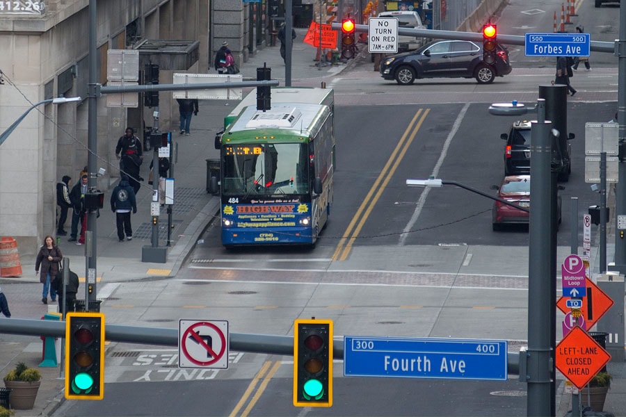
Yathirajam was part of a student team that developed the prototype by creating a pictorial representation of the Baum to Centre Avenue corridor from Euclid Avenue to the Liberty/Aiken Avenue intersection — a neighborhood the city intends to renovate someday. City planners also can use the tool when working elsewhere.
The project was divided into four phases. For Phase I, three graduate students from the Heinz College researched existing 3D tools currently used by planning departments, universities and private firms.
The students also talked to urban planners across the U.S. about what features were important.
"Many urban planners don't have the time or resources to investigate this because they are trying to keep up with their day-to-day tasks," said Chris Worley, a student studying information systems management. Sonya Acosta, a public policy and management student, and Lu Zhu, an urban design student, also conducted benchmarking.
In Phase II, students and faculty in the ETC met regularly with the research team, Gastil, and his staff to bring the VR tool to life. That process exemplifies the ETC philosophy.
"We build solutions iteratively along with the client to deliver to the client," said Jessica Trybus, an ETC special faculty member.
Students said the challenge was to create something affordable and user-friendly for people without programming experience. The prototype is based on software found in video games and movies.
Students and faculty worked with Pittsburgh City Planning to determine which details to include and which ones to leave out to create an immersive experience. Gastil had them incorporate standard planning features by mapping out shadows for each season and adjusting building heights, traffic density and the number of pedestrians.
The students programmed flexibility into the app to give urban planners expansive options. Through toggling the controls, planners could study various scenarios quickly. What would happen if you widened the street or added bike lanes? How would adding a tall building change the shadow pattern, the solar impact or the street scale? Would adding more retail shops make it feel safer? How would a street look in the winter versus the summer?
They discovered that putting in lamp posts, benches, landscaping and other foreground details would have given the tool a more realistic feel. "You don't need details in the distance. Your mind fills those in," said Steve Quick, adjunct professor of architecture.
"In time, virtual reality simulation may become more useful for understanding the experiential quality of a place," Quick said. "One responds experientially and emotionally to place. It is the sum of all the things your brain observes, subtly and not subtly."
But for all the innovation, the tool will not be on the market next week.
"What was created was a prototype," said Thomas Corbett, special faculty with the ETC. "It's more of a suggestion of what we can expect from urban planning software of the future."
A photo shows an area near the intersection of S. Negley and Centre avenues in Pittsburgh. Sujan Das Shrestha, a MUD graduate student, created a visualization of how the space could be redesigned. The MUD urban systems studio applied 3D software to a series of data and design projects.
This spring, another group of graduate students in the Master of Urban Design (MUD) program tested the prototype and other 3D and virtual reality software on the same Baum-Centre business district, Kurland said. The MUD urban systems studio applied the 3D software to a series of data and design projects, including virtual reality place-making, that the research team identified as potentially useful for urban and city planning. After the testing, the CMU research team will work with Pittsburgh City Planning to decide what software is most useful for various scenarios.
"We will publish a final report for the Heinz Endowments that will include a public website with our results and recommendations," Kurland said.